
Ancient navigational skills are the cornerstone of human exploration, facilitating movement across vast, uncharted territories. These skills enabled our ancestors to traverse oceans, deserts, and mountains with a surprising degree of accuracy. Although technological advancements have dramatically changed the face of navigation, the fundamental principles established thousands of years ago remain relevant. Delving into these ancient techniques provides us with not only a profound appreciation for early explorers but also insights into the evolution of global travel and trade.
Understanding ancient navigational skills is essential for grasping how civilizations flourished through exploration. By examining the methods used to determine direction and manage travel routes, historians and enthusiasts can recreate the very journeys that led to monumental discoveries. The sophistication of these skills is evident in both the simple and complex tools employed, from natural signs to intricate instruments such as the astrolabe. As we embark on this exploration, we uncover how early navigators adapted to the challenges they faced and the ingenious solutions they devised.
The Role of Celestial Navigation in Ancient Times
Celestial navigation, one of the earliest navigational methods, relied on the positions of celestial bodies like stars, the sun, and the moon to guide travelers. Ancient mariners and land travelers alike harnessed the predictable patterns of celestial movement, using them as a reliable compass. This technique was especially crucial for sea voyages, where no physical landmarks provided guidance.
One of the most vital celestial bodies for navigators was the North Star, Polaris. Located nearly directly above the North Pole, Polaris served as a constant point in the night sky, helping navigators maintain a consistent course. The ability to find this star and understand its significance was a critical skill for anyone wishing to travel long distances.
Celestial navigation required extensive knowledge of astronomy. Ancient navigators meticulously documented the movements of celestial bodies, developing a complex understanding of how their positions changed with the seasons. This knowledge allowed for the creation of star charts and other navigational aids essential for charting course.
How Early Explorers Used the Stars, Sun, and Moon for Direction
Early explorers relied heavily on the stars, sun, and moon to orient themselves and chart new territories. The sun’s daily path across the sky provided a simple yet effective method for determining east and west, while its highest point at noon indicated true north or south, depending on the hemisphere.
At night, stars became the primary guide. Besides Polaris, constellations like Orion and the Southern Cross served as navigational beacons. Sailors could triangulate their position by measuring the angle of these stars above the horizon, a technique that evolved into more sophisticated methods like the use of the sextant.
The moon also played a role in navigation. By noting its phase and position, navigators could estimate the time and ensure they maintained an accurate course. Ancient Greeks and Romans, for instance, developed lunar calendars that helped plan voyages and agricultural activities. This celestial clock was an integral part of the complex web of observation that early navigators mastered.
Traditional Wayfinding Methods Used by Indigenous Cultures
Indigenous cultures around the world developed their own traditional wayfinding methods, often using environmental cues unique to their regions. These techniques were passed down through generations and adapted to the specific landscapes and climates they inhabited.
Polynesian navigators, for example, were renowned for their ability to traverse the vast Pacific Ocean without modern instruments. They used a combination of star paths, wave patterns, and the flight patterns of birds to navigate. By observing how the swell of the ocean behaved in different conditions, Polynesians could maintain their course over thousands of miles.
Native American tribes, such as the Plains Indians, utilized the natural landscape to guide their movements. By recognizing landmarks, understanding wind patterns, and even interpreting animal behavior, they could effectively navigate large swathes of land. These skills were crucial for hunting, trading, and warfare, influencing the survival and prosperity of their societies.
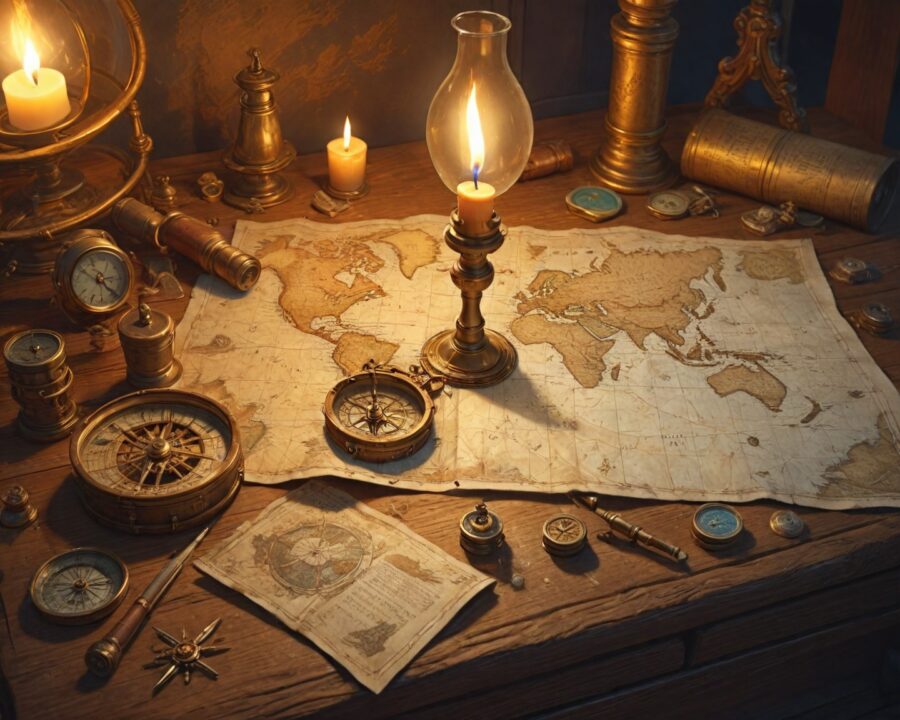
The Evolution of Navigational Tools: From Compasses to Astrolabes
The development of navigational tools marked significant advancements in exploration capabilities. One of the earliest tools, the compass, revolutionized travel by providing a reliable means of determining direction independent of celestial cues.
| Tool | Description |
|---|---|
| Compass | Uses Earth’s magnetic field, indicating magnetic north. |
| Astrolabe | Measures altitudes of celestial bodies, helping fix navigator’s position. |
The astrolabe, an intricate device developed in the Islamic world, allowed navigators to measure the altitude of the sun or a star. This measurement helped determine the latitude of the observer, enabling more precise navigation. These advancements not only improved the accuracy of ancient voyages but also expanded the range and complexity of routes explorers could undertake.
Over time, these tools were refined and adapted. The cross-staff and backstaff allowed for easier angle measurements, and later, the sextant emerged as the most sophisticated tool of its time, capable of greater precision and ease of use. These instruments laid the groundwork for the 18th-century breakthroughs that would help launch the Age of Exploration.
Common Challenges Faced by Ancient Navigators and Their Solutions
Despite the advancements in navigational skills and tools, ancient navigators faced numerous challenges during their journeys. Harsh weather conditions, limited visibility, and navigational errors posed significant threats to explorers.
Unpredictable weather, such as storms and fog, could obscure celestial bodies, rendering traditional methods ineffective. Ancient navigators developed a keen understanding of weather patterns and signs, often using cloud formations and wind directions to anticipate changes.
Navigational errors could lead to disastrous consequences, including shipwrecks or being lost at sea. To mitigate these risks, navigators combined multiple techniques, cross-checking celestial observations with dead reckoning, which involved estimating their current position based on speed, time, and course traveled since the last known point.
The Impact of Ancient Navigation on Global Exploration and Trade
Ancient navigational skills laid the foundation for global exploration and trade, propelling societies into new eras of interaction and cultural exchange. The ability to navigate vast distances allowed for the establishment of trade routes that connected distant regions, fostering economic and cultural prosperity.
The Silk Road, for example, was a network of trade routes that linked Asia, the Middle East, and Europe. Navigators played a crucial role in facilitating this exchange of goods, ideas, and technologies. Similarly, maritime trade routes, such as those established by the Spice Trade, relied heavily on navigational expertise to connect the East and West.
The legacy of ancient navigation is evident in the cultural and technological diffusion that it enabled. The exchange of goods and ideas along these trade routes led to significant advancements in knowledge, contributing to the development of early sciences and technologies in societies across the globe.
Famous Historical Figures and Their Contributions to Navigation
Throughout history, numerous individuals have made remarkable contributions to the field of navigation. These pioneers paved the way for future explorers and left a significant impact on the course of exploration.
One such figure is Prince Henry the Navigator of Portugal, who established a school for navigators in the 15th century. His efforts led to the development of new navigational techniques and the exploration of the West African coast. His influence kickstarted the Age of Discovery, opening up new pathways for global trade.
Another key figure was the Greek mathematician and astronomer, Ptolemy. His works on geography and navigation, including the creation of maps and latitude lines, provided a foundation for later cartographers and navigators. His ideas influenced exploration efforts for centuries, even guiding Christopher Columbus on his voyage to the New World.
Lessons Modern Navigation Can Learn from Ancient Techniques
Modern navigation systems, while advanced, can still draw valuable lessons from ancient techniques. These historical practices emphasized critical thinking and adaptability, skills that remain relevant in today’s rapidly changing technological landscape.
One lesson is the importance of understanding the natural world. Ancient navigators relied heavily on environmental cues, demonstrating a profound awareness of their surroundings. Modern navigators can benefit from this holistic approach, combining technological reliance with a fundamental understanding of natural navigation aids.
Another takeaway is the concept of redundancy in navigation. Ancient navigators often used multiple methods to verify their position, ensuring accuracy and safety. This practice of cross-verifying information can enhance the reliability of modern navigation systems, especially in situations where technology might fail.
Practical Ways to Explore and Preserve Ancient Navigational Knowledge Today
Preserving ancient navigational knowledge requires a concerted effort to document and disseminate these timeless practices. Educational programs and research initiatives play a critical role in exploring and preserving this heritage.
Institutions can offer courses that combine historical study with practical navigation exercises, immersing students in both theory and application. Such programs can rekindle interest in ancient methods while bridging the gap between past and present techniques.
Engaging with indigenous communities and cultural historians provides invaluable insights into traditional practices. By fostering collaboration and dialogue, we can ensure these methods are acknowledged and preserved for future generations.
FAQ
What is celestial navigation?
Celestial navigation is the practice of determining one’s position and course using the positions of celestial bodies, such as stars, the sun, and the moon.
How did sailors use the North Star?
Sailors used the North Star, Polaris, as a fixed point in the sky to maintain a consistent heading, as it is aligned closely with the Earth’s rotational axis.
What are wayfinding methods?
Wayfinding methods are traditional navigation techniques that utilize environmental cues like stars, ocean swells, and landmarks for guidance, often used by indigenous cultures.
How did the compass change navigation?
The compass provided a reliable means to determine direction independent of visual cues, revolutionizing navigation by allowing travel under any weather conditions.
What is an astrolabe?
An astrolabe is a historical astronomical instrument used to measure the altitude of celestial bodies, thus helping navigators determine their latitude.
What challenges did ancient navigators face?
Ancient navigators faced challenges such as adverse weather, limited visibility, and navigational errors, requiring them to develop adaptive strategies and tools.
How did ancient navigation impact trade?
Ancient navigation enabled the establishment of trade routes, facilitating cultural exchange and economic prosperity across disparate regions of the world.
Can ancient techniques benefit modern navigation?
Yes, ancient techniques emphasize critical thinking, adaptability, and understanding of natural systems, offering valuable lessons that can enhance the reliability of modern navigation.
Recap
Ancient navigational skills were instrumental in shaping exploration, trade, and cultural exchanges throughout history. From celestial navigation to indigenous wayfinding methods, these techniques demonstrated remarkable ingenuity in overcoming the challenges of the natural world. The evolution of navigational tools, such as compasses and astrolabes, further propelled global exploration. The lessons from ancient navigators—adaptability, redundancy, and understanding of the natural environment—remain relevant in today’s technological age, providing invaluable insights for modern navigation. Recognizing and preserving these ancient practices allows us to appreciate the enduring legacy of human exploration.